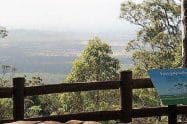
Numinbah Forest Reserve is located at the foothills of the Border Ranges, just 40 kilometres North of Murwillumbah, or 25 kilometres South-West of Nerang.
It is one of the most popular natural attractions in Queensland, with a variety of wildlife and an amazing landscape.
Numinbah Forest Reserve Camping & Walk Trail Maps
Many people visiting the Gold Coast will take a drive through the Numinbah Valley and stop for a BBQ or picnic near the beautiful Nerang River. At this location, there are BBQ facilities, picnic tables and toilets on site. Dogs on leashes are also permitted in this part of the park.
If you want to go horse riding or cycling through the Reserve, you will need to obtain a permit which is available from the Information Centre. Alternatively, go for a walk through the Forest Reserve on one of the many tracks. As there are no formal tracks through here, visitors need to be careful that they have sufficient drinking water and a map of the area so that they don’t get lost.
To get to the Numinbah Forest Reserve by car, leave the Pacific Motorway at Nerang (exit 69) and follow the Nerang-Murwillumbah Road for 25km. From the other direction on this route, this part of the park is 42km north-west of Murwillumbah.
An alternative scenic route is 28km via the Springbrook plateau from Mudgeeraba. From the Pacific, Motorway take exit 79 from the north or exit 80 from the south and follow the Gold Coast-Springbrook Road to the plateau.






















Do You Have a Question to Ask?